"Arribas do Tejo (Tagus River Valley Slopes)
Code: GAV PR1
Geographical location: Gavião
Type: Circular walk
Main themes: Nature, the River Tagus, Cultural Heritage, Scenery
Distance: 16 km
Approximate duration: 4 to 5 hours
Type of surface: Nature trails and urban walks, wooden walkway
Ascent/descent: 615 m
Minimum altitude: 40 m
Maximum altitude: 188 m
Level of difficulty: Medium +
Accessibility: Not suitable for people with reduced mobility.
Certifications: Approved by the FPCM (Portuguese Camping and Mountaineering Federation)
Start and finish: Largo Luis de Camões, Belver
Geographical coordinates: N39º29'39'' W07º57'32''
Geographical coordinates: 39.494234º -7.958965º
Where to park: Parking available in the immediate vicinity, within the built-up area.
Useful Contacts:
Gavião Tourist BoardTelephone: +351 241 631 210
E-mail: turismo@cm-gaviao.pt
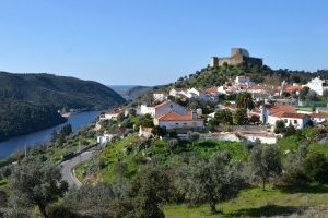
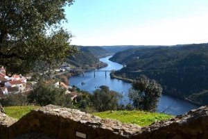
This is the part of the Alentejo region located to the north of the River Tagus. In mediaeval times, the area was defended by Belver Castle. These were the Lands of Guidintesta, given over to the Order of the Hospital, which built a replica of Jerusalem's Belvoir Fortress here. The river marks a trail through nature teeming with life; here, too, are megalithic remains, historical defensive structures, ancient but now submerged river and sulphurous spas, and a huge, dammed reflecting pool, bounded by a romantic walkway.
A thrilling trail through magnificent landscapes, affording views over both banks of the River Tagus. This is a route which features many foot trails in natural surroundings, with various uphill and downhill stretches through areas of virtually untouched nature, with a number of obstacles to be tackled and a wooden walkway alongside the river.


