Flor da Rosa Historical Route
Code: CRT PR1
Geographical location: Crato
Type: Linear
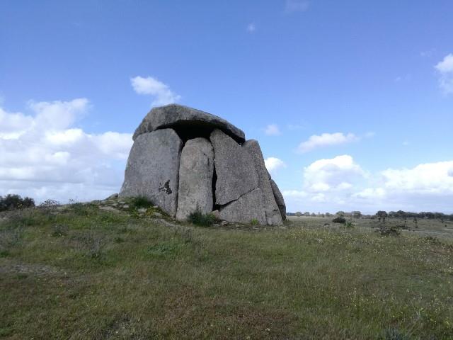
Main themes: History, Megalithic Period, Rurality
Distance: 20.8 km
Approximate duration: 5 to 6 hours
Type of surface: Country paths
Ascent/descent: 321 m
Minimum altitude: 196 m
Maximum altitude: 300 m
Level of difficulty: High
Accessibility: Not suitable for people with reduced mobility.
Certifications: Approved by the FPCM (Portuguese Camping and Mountaineering Federation)
Start: Rua do Mosteiro, entrance to Flor da Rosa Castle
Geographical coordinates: N39º18'21"" W07º38'53""
Geographical coordinates: 39.305894º -7.648117º
Where to park: Open space for parking at the site.
Finish:
Geographical coordinates: N39º18'03'' W07º42'39''
Geographical coordinates: 39.3000954º -7.710968º
Useful Contacts:
- Crato Tourist Board
- Telephone: +351 245 997 341
- E-mail: turismo@cm-crato.pt
A vast territory was the headquarters of the Knights Hospitaller, now known as the Order of Malta, lands belonging to the Álvares Pereira family, to which the history of Portugal owes so much. Between legends of deadly loves in Flor da Rosa and secular defences in the Castles, we have fertile lands that have been peopled with scattered settlements since prehistoric times. Today, this is marvellous countryside for walking; you can feel the energy from those bygone days, in landscapes that have already borne witness to so many fabulous civilisations.
The considerable length of this route means that it is suited to those who enjoy long-distance walking. But the distances seem to be made shorter due to the beautiful scenery and the tranquillity of the endless horizon.