Lines of Elvas
Code: ELV PR2
Geographical location: Elvas
Type: Linear
Main themes: Military Defences, Heritage
Distance: 6 km
Approximate duration: 2 hours
Type of surface: Country paths
Ascent/descent: 154 m
Minimum altitude: 247 m
Maximum altitude: 380 m
Level of difficulty: Easy
Certifications: Approved by the FPCM (Portuguese Camping and Mountaineering Federation)
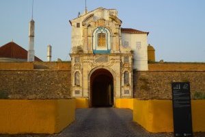
Start and finish: Exterior door of the Graça Fortress
Geographical coordinates: N58º53'35,82'' W07º09'51,94''
Geographical coordinates: 38.893290 -7.164432
Where to park: Public car park at the site.
Useful Contacts:
- Elvas Tourist Office
- Telephone: +351 268 622 236
- E-mail: turismo@cm-elvas.pt
Description:
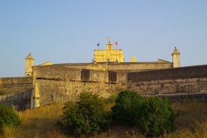
Exploring Elvas and its lines means being in one of the most important barrack cities in the whole world. Military defences from the past are today historical witnesses to bygone times; they are a delight, in part because of the perfection of their construction and the marvellous preservation of the heritage they represent; and also because of the beauty of the scenery in which they stand. Extremely rich religious heritage developed alongside this military system with many temples being built and records kept; and civilian heritage reach its peak with the construction of the majestic aqueduct.
This is a route where built heritage and the urban space are noticeably present and where nature surprises us with the fantastic scenery that we see along the way. The old country paths of the past have now given way to stretches of road that you can walk along in comfort, on your way to the fortresses that mark the start and end of the walk. The urbans spaces of the city of Elvas are surprising due to the profusion of narrow streets and alleyways in the city centre and the walls, doors and bulwarks that mark the defensive enclosure.


