Monumental Estremoz
Code: ETZ PR4
Geographical location: Estremoz
Type: Circular walk
Main themes: Heritage, Scenery, Rurality
Distance: 11.4 km
Approximate duration: 3 to 4 hours
Type of surface: Country paths and roads
Ascent/descent: 210 m
Minimum altitude: 324 m
Maximum altitude: 423 m
Level of difficulty: Medium
Certifications: Approved by the FPCM (Portuguese Camping and Mountaineering Federation)
Start and finish: Estremoz Tourist Information Office
Geographical coordinates: N38º50'30'' W07º35'07''
Geographical coordinates: 38.841690º -7.5854690
Where to park: Public car park at the site.
Useful Contacts:
- Estremoz Tourist Office
- Telephone: +351 268 339 227
- E-mail: turismo@cm-estremoz.pt
Description:
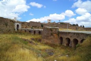
In Estremoz, we appear to have found the ideal Alentejo, where the monumentality of the historic heritage crowns, from atop the hill, the endless croplands and vineyards below. In the distance, like a film set, the jagged profile of the Serra de Ossa uplands cuts into the horizon; and, with every step, we are surprised by new landscapes that seem almost to have been cut geometrically into the farmland. From underground, we get the white marble that is the hallmark of churches, chapels, palaces and crazy-paving.
The square called Rossio de Estremoz is one of the most monumental in the Alentejo and is the starting point for a route that quickly takes you out of the built-up area. Once in the countryside, you will always be walking along farm paths, winding their way amid vineyards and cropland. The scenery is magnificent and the easy access means you can be sure of an unforgettable day out.


